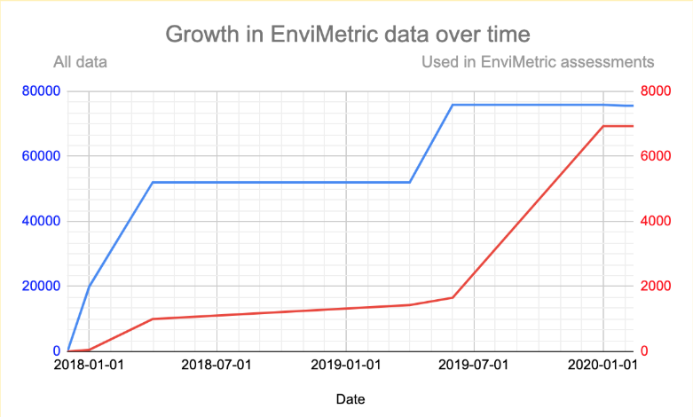
Our goal with EnviMetric™ is to build innovative products on top of a data repository for remediation sites that is unrivaled in the industry. Through our sponsorship from the National Science Foundation we’ve compiled what may be the largest detailed database of remediation sites in the world. In Q3 and Q4 of 2019 we were able to quadruple the amount of sites we use when doing comparative remediation site modeling, up to well over 75,000 across the United States.
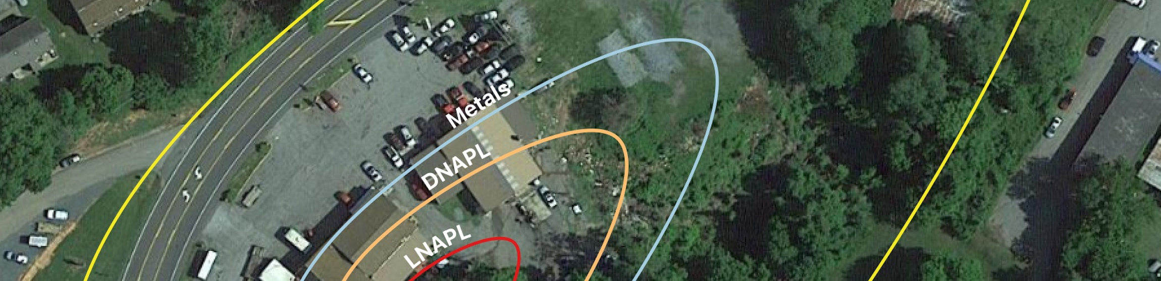
This data was compiled, normalized, and annotated by our team of data curators who take information from state DEQ databases, voluntary remediation programs, underground storage tank programs, PDF downloads, published EDDs, FOIA requests, and historical data. Using this varied and specific data yields an accurate and precise measure of the estimated plume boundaries at any comparable site.
As we compile this data and and continue to gain insights from site investigations, we’ll periodically share some interesting snapshots of data that we find and thought you would like to know about.
To get us started, below are just a few things we’ve learned from modeling groundwater plume sizes.
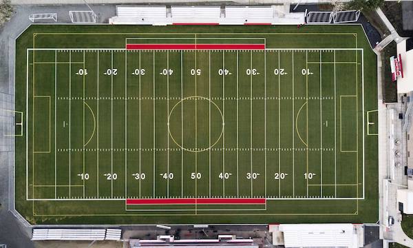
The US national average groundwater plume is about the size of a football field.
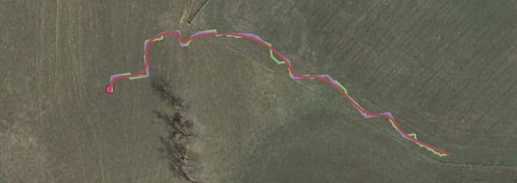
But there’s more to the story than just averages. There is a tremendous amount of variability in plume sizes with an especially long tail (a small number of extremely long plumes). The longest plume we’ve seen so far was over 13 miles long (about as long as Manhattan). This means that when analyzing plume boundaries, you should note that there is a higher likelihood that you expect that the plume extends beyond that average size.
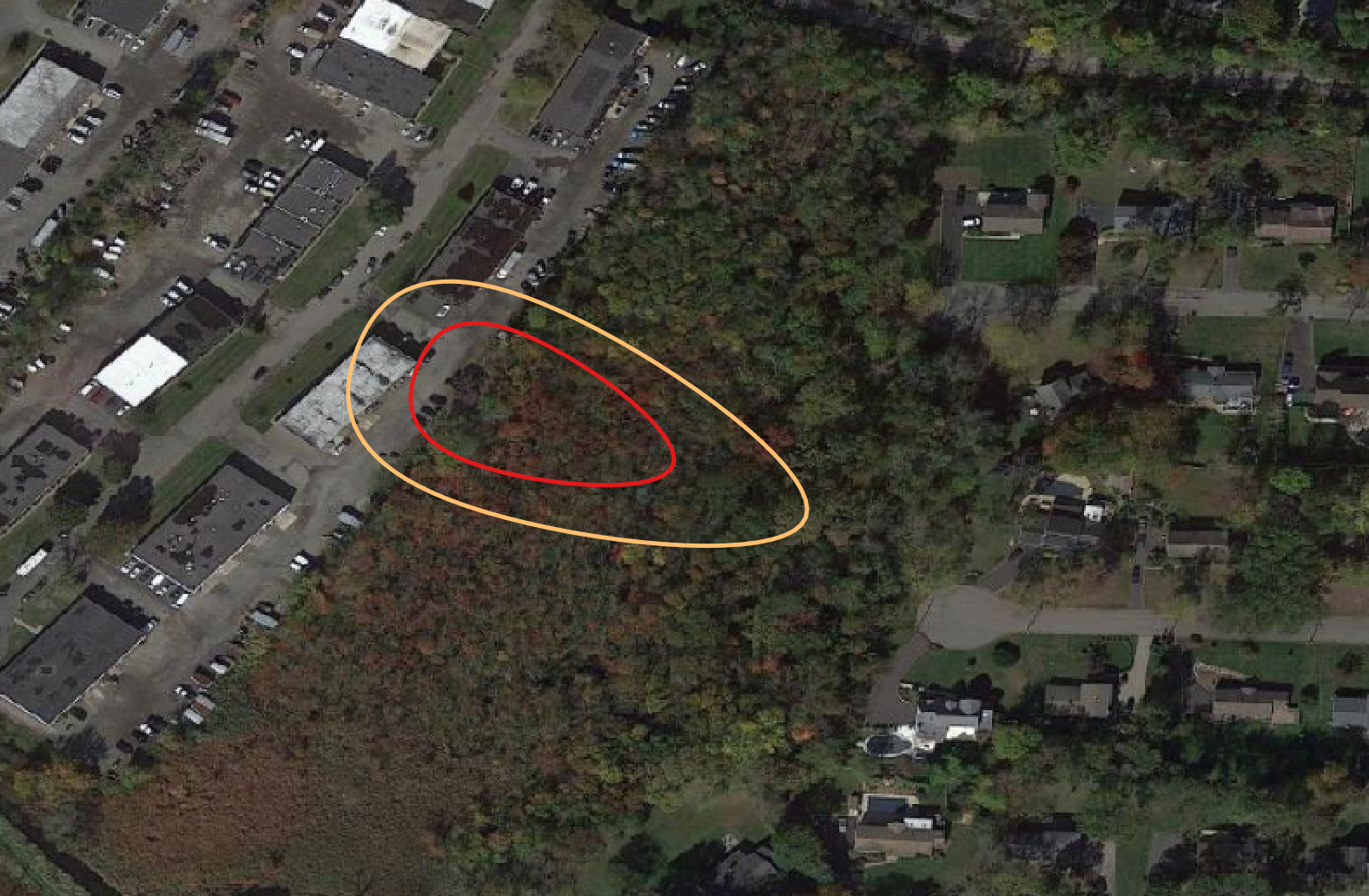
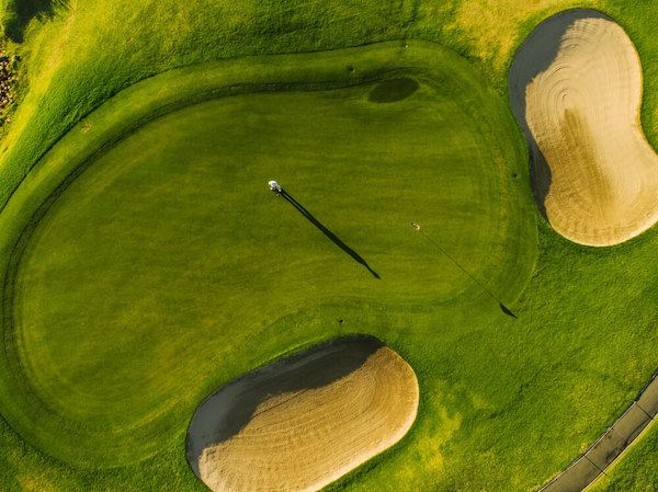
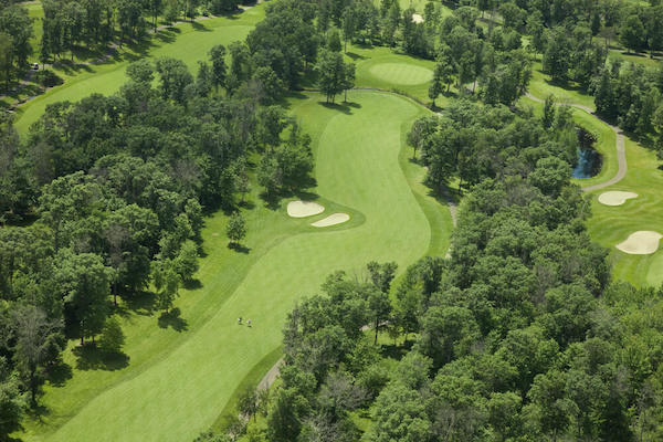
Are you a golfer? About 80% of all contaminated groundwater plumes are larger than a putting green but smaller than a par 4.
If you’re investigating a plume boundary, odds are you’re somewhere in that range, but narrowing the range within these boundaries can often be difficult. EnviMetric gives you the probability that your plume is contained within a specific range, and gives a specific confidence level calculated for your environmental site assessment. So you know in quantitative terms the probability that the plume exceeds a set boundary. This insight into risk and expected future cost of remediation is vital to the project plan.
About 10% of groundwater plumes are larger than the New Orleans Superdome.

Whether your site has a plume the size of a putting green or the Superdome, having the context and insight gained from thousands of similar sites can provide more certainty and confidence as you delineate a conceptual site model and make recommendations for remediation. Find out more about how EnviMetric can give you that confidence.
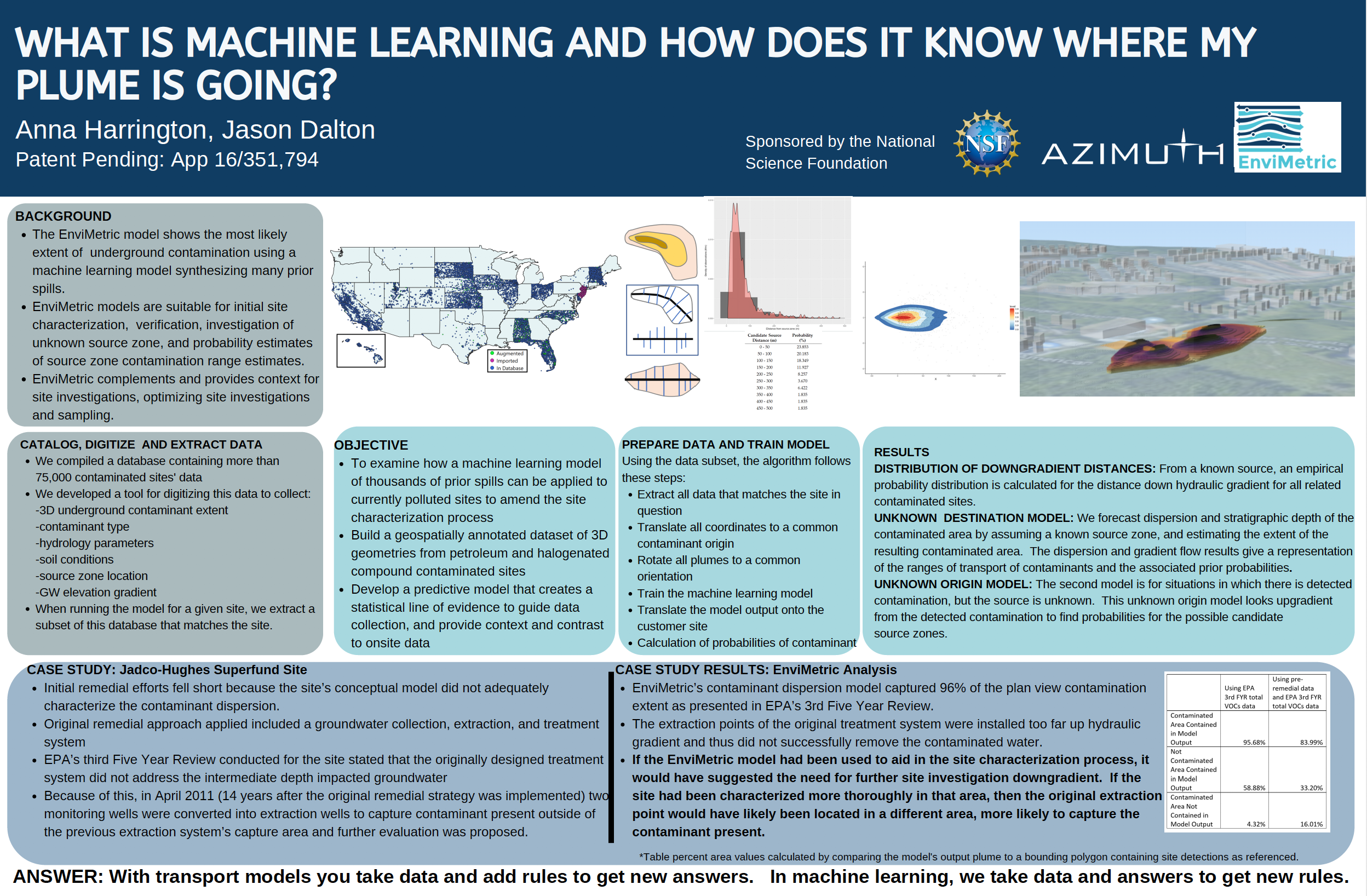
AEHS Presentation Poster
We’ve been up to a few interesting things lately with a presentation at AEHS on machine learning and plume mapping. You can download our poster here.
We’ll be presenting at the Battelle Chlorinated Conference in Portland in May-June. It’s session G5: Big Data, Data Mining, and Portfolio Optimization. Check out the entire program here (We’re on page 57). If you’ll be at Battelle, we’d love to schedule a short meetup so we can show you EnviMetric in more detail and talk about how it can be most useful to you.